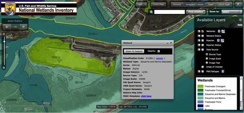
There is a tool provided by the U.S. Fish and Wildlife Service called the Wetland Mapper that provides printable maps of habitat types for the United States (USFW 2013b). The habitats are delineated by colors and given specific codes representing Wetlands and Deepwater Habitats Classification Hierarchy, which shows the relationship of wetland systems. The Wetland Code Interpreter allows you to input a code and get information on that habitat type including system type (e.g. estuary), possible plant life, and water regime.
If information is not provided for the estuary that you’ve identified, a great resource for mapping is the, Data Collection Requirements and Procedures for Mapping Wetland, Deepwater and Related Habitats of the United States.
US Fish and Wildlife Services Resources: