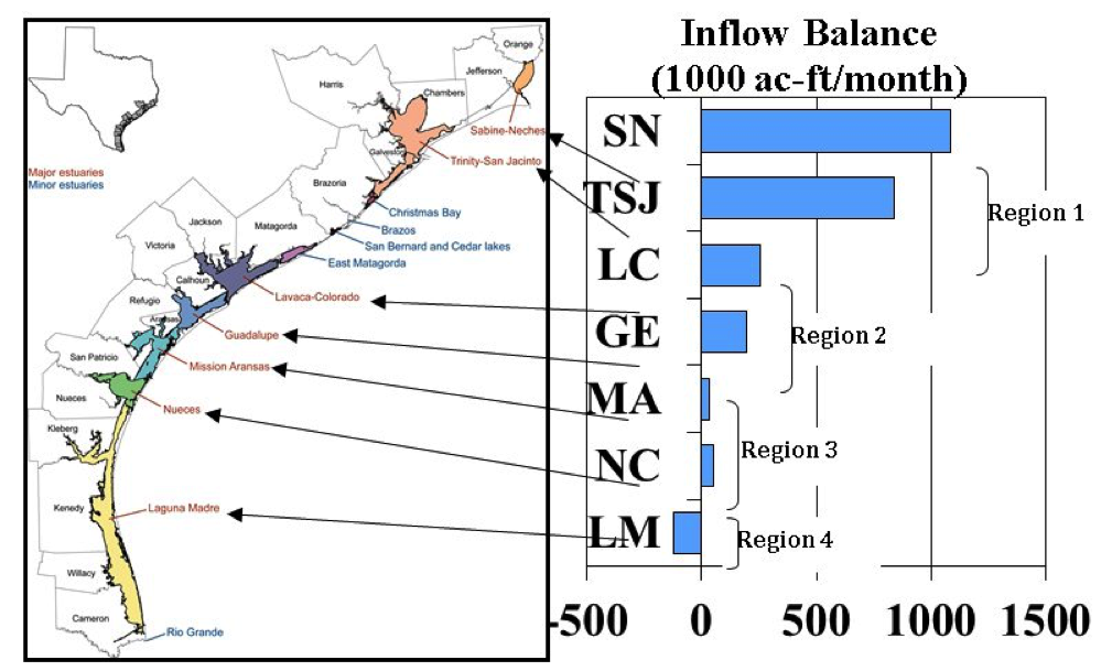
The Texas Water Development Board (TWDB) has established a method for calculating the total freshwater inflows reaching an estuary using United States Geological Survey (USGS) stream gauges placed upstream of 7 estuarine systems in Texas: Sabine-Neches Estuary (Sabine Lake), Trinity-San Jacinto Estuary (Galveston Bay), Lavaca-Tres Palacios Estuary (Matagorda Bay), Guadalupe Estuary (San Antonio Bay), Mission- Aransas Estuary (Aransas Bay), and Nueces Estuary (Corpus Christi Bay) from as far back as 1941.
The figure below shows sites where data was collected. The Texas coast is an ideal study area because the inflow balance decreases from northeast to southwest creating a gradient for estuarine comparison. The major estuaries in red are those that are bar-built estuaries, meaning they have parallel adjacent sandbars, islands or peninsulas.
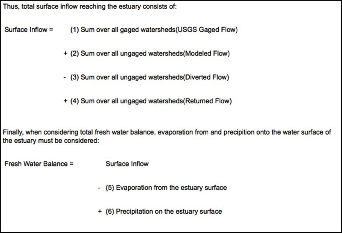
**The Information below for total surface inflows was taken directly from the TWDB website:
“Total flow from drainage basin runoff is found by summing flows originating in both gaged and ungaged watersheds. Gaged flows are obtained from USGS streamflow records. Ungaged runoff is the sum of
- i) computed runoff, using a rainfall-runoff simulation model, based on precipitation over the watershed
- ii) flow diverted from streams by municipal, industrial, agricultural, and other users
- iii) unconsumed flow returned to streams” (TWDB 2012)
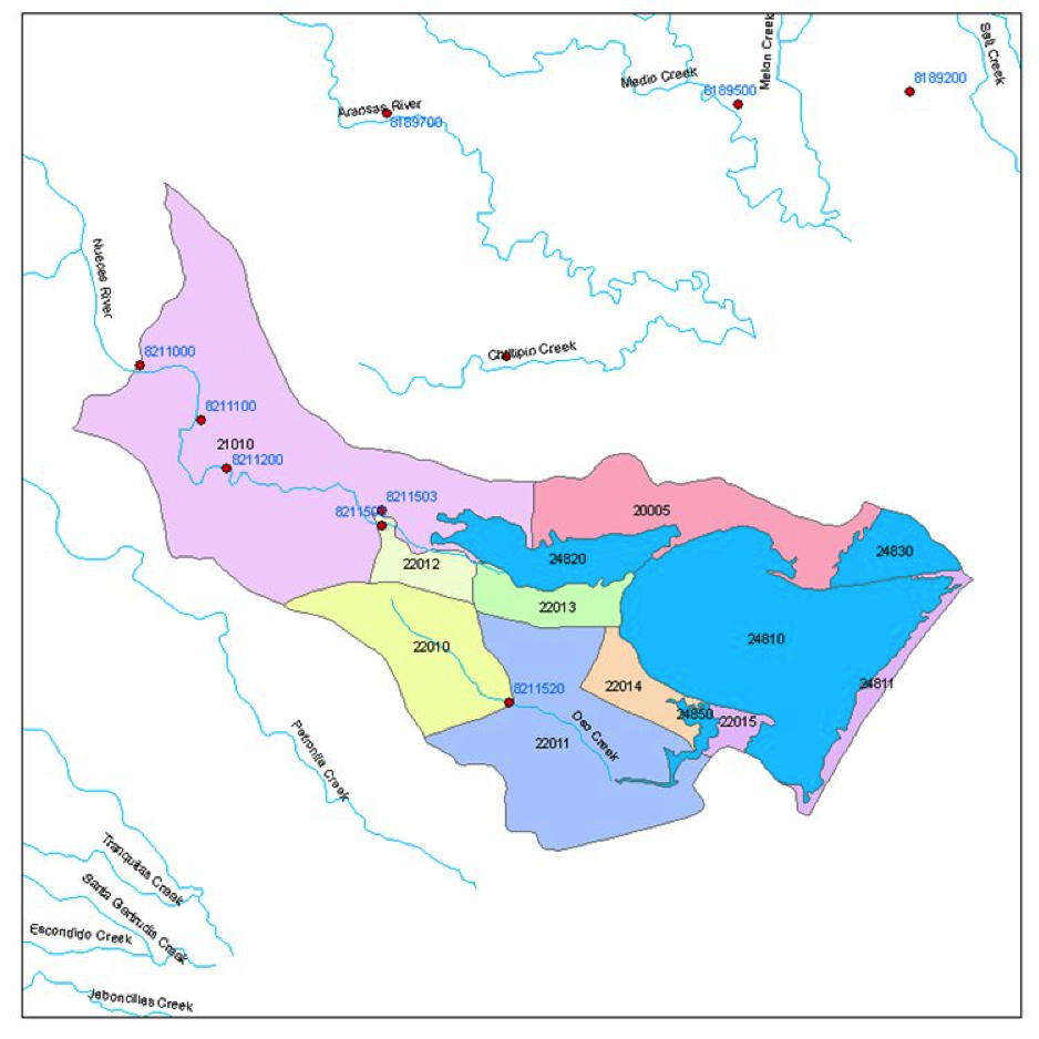
An example of the spatial placement of USGS gages is shown below:
Basin Wide Inflow summaries are also available online through the Texas Water Development Website.